|
Innovative software program gettings from the most asked for in download catalogues! Investigate the called for software program lists, find out the freshest refreshes of the cutting-edge apps, and get right away! Do not toss away opportunity to acquire the greatest applications: use SoftEmpire to recieve utilities for free. Check out the directory of free utilities and app test versions. Choose among Windows and Linux services programs, setup planners, playgames, and all other types of programms for your PC or digital accessory!
Multimedia software to view video, listen audio, view images. Video viewers, decoders and converters are available in our catalog. Video software for PC, iPhones and other mobile devices. Audio software helps you convert your favorite music and play on your favorite audio device like iPhone, MP3 flash player etc. Image viewers work fast and allow to convert in any image formats. Best multimedia software in our catalogue.
|
Canvas GIS Mapping Edition (Mac)
|
|
Download
|
Buy now!
|
View screenshots
|
Vendor Price: $ 549.99
License: Shareware
File Size: 51.90 Mb
Version: 9.0.4
Release Date:
30 Apr 2004
OS: Mac PPC
System Requirements:
PowerPC, Mac OS X, 128 MB RAM 100 MB HD, 16-bit graphics, 1024 x 768 res
Company: ACD Systems
|
|
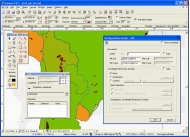
The CANVAS 9 GIS Mapping Edition adds native support for Geographic Information System (GIS) data to Canvas. You can take measurements in geographic coordinates, import industry standard SHAPE and GeoTIFF files into unlimited numbers of automatically aligned overlapping layers and choose among the following options:
2, 104 Coordinate Reference Systems
67 Operation Methods (like Mercator, Albers Conic Equal Area?)
1, 052 Map Projections
302 Geodetic Datums
21 Angular units
45 Length units
The CANVAS 9 GIS Mapping Edition bridges the gap between dedicated GIS analysis software and generic "DTP" software. For many applications CANVAS 9 GIS Mapping Edition can now replace programs costing thousands. For the rest, CANVAS 9 GIS Mapping Edition is now the preferred "last mile" publishing companion to dedicated GIS analysis software.
|
More to download:
Site Map Pro
Create a site map or Yahoo or Google Sitemap Protocol XML for any website or for offline CD/DVD use. Site Map Pro will create a self contained HTML file. Place this file on your site to provide full navigation facilities for your visitors.
CommView
CommView is a program for monitoring Internet and Local Area Network (LAN) activity capable of capturing and analyzing network packets. With CommView you can see the list of network connections and vital IP statistics and examine individual packets.
Interspector 2.0 + HTML plug-ins
InterspectorTM is a code-based HTML/XHTML/XML editor. An inovative approach allows Interspector to massively decrease web site maintenance time by eliminating repetitions. Cut maintenance time in HALF. Key features
Smart Tokens. Edit repetitiv...
Coeli - Stella 2000
Complete astronomy software suite exploring realistic skies in real time, with observing log, Live Orbits, Sky Quiz, spoken guidance, A-Z encyclopedia, and a concentrated search embracing planets, comets, asteroids, DSOs, and 300,000 stars.
Workgroup Contacts
Workgroup Contacts is a program for sales or service team professionals. It allows members of a team to share contact interaction information, schedule without creating conflicts, and coordinate their efforts toward successful project completion...
Versamap for Windows
Versamap draws outline maps on 16 map projections. Plot great and small circles. Print publication quality maps. Export maps in vector (WMF, CGM, DXF, ASCII) and bitmapped (BMP) formats. Add text to maps. Plot your own data in a simple ASCII format.
Easy Button Creator
Easy Button Creator is intended for easy creation of 3D buttons on basis of prepared templates. You can edit parameters of the button,caption,light source,shade and save created image to GIF, JPEG, BMP, PNG. Also you can create your own templates.
Desktop Activity Recorder
Desktop Activity Recorder records screen activity from your Windows Desktop into standard AVI movie files. It is an ideal tool for developing videos to demonstrate features of new software or any other task that requires capture of desktop activity
|
|
|
Windows Backup |
Looking for backup software? Try Handy Backup - automatic data backup to DVD, CD, FTP, network, or Online. Client-server enterprise backup software.
|
|
Top Downloads |
SimplySMS: Send/Read SMS (via serial port) for GSM phones (Siemens,Nokia,others)
Convert 3GP files to MP4 and AVI, video with Free 3GP Video Converter
Simple and flexible Personal Accounting Software
|
|